AI-Powered Solar Panel Detection from Satellite Imagery
Aviasole Technologies - Internal R&D / Innovation Prototype
We built an AI tool that can look at any address in the world and tell you whether there are solar panels on the roof - instantly, from satellite imagery, with no human involvement.
Where This Idea Came From
One of our engineers was looking at rooftops on Google Maps and thought: could an AI just… tell you which buildings have solar panels? Not manually tagging images - actually looking at satellite data in real time and giving you an answer.
That question turned into a working prototype in a matter of weeks. We built it internally as an R&D project, tested it across four continents, and the results surprised us.
The Problem We Were Solving
Right now, if an energy company, insurer, or local government wants to know how many buildings in an area have solar panels, they have limited options. They can send surveyors out. They can buy expensive datasets. Or they can guess.
None of those options scale well. Sending people to physically check thousands of properties is expensive and slow. Buying pre-built datasets means working with information that’s already out of date.
We wanted to see if we could remove that bottleneck entirely - let someone type an address, and get an answer in seconds.
What We Built
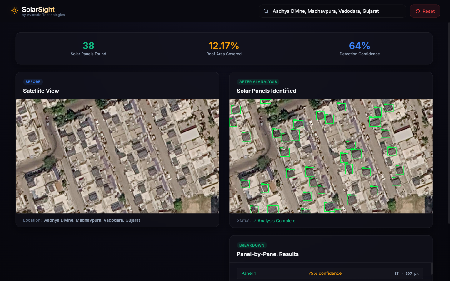
The tool is simple to use. You type any address anywhere in the world. The system pulls satellite imagery of that location, runs it through an AI model trained to recognise solar panels, and gives you back a visual result - the original image on one side, and the AI-annotated version on the other, with every detected panel outlined in green.
You also get three numbers: how many panels were found, what percentage of the roof they cover, and how confident the AI is in its detections.
The whole thing runs on a standard server. No specialised graphics hardware. No cloud GPU costs. That matters a lot when you’re thinking about deploying something like this at scale.
We Tested It Across the World
We didn’t just run it on a handful of familiar locations. We tested it on real addresses across Asia, North America, Europe, and Africa - using live satellite data, not pre-selected examples.
Asia - Vadodara, India
38 solar panels detected · 64% confidence
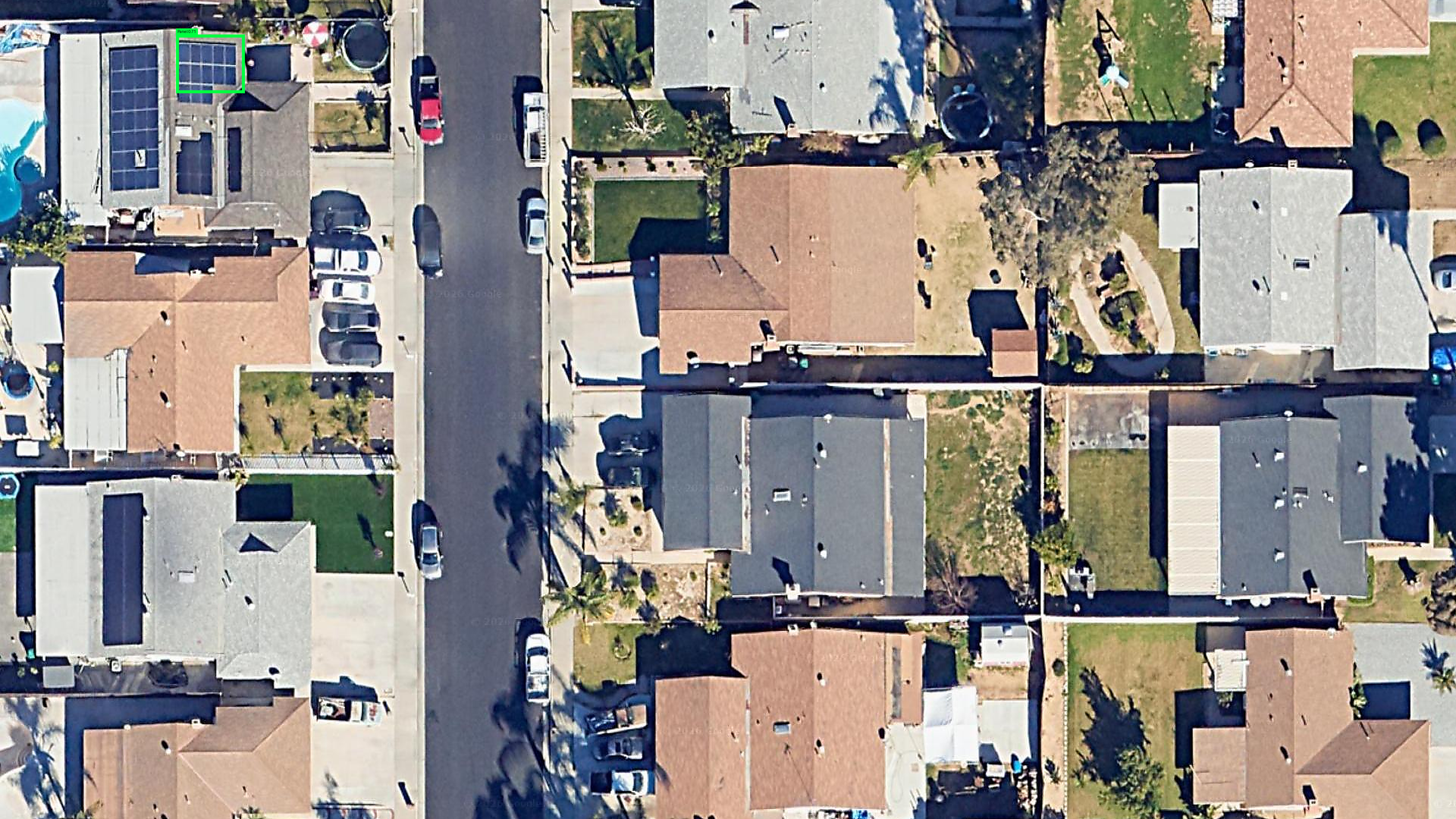
USA - Moreno Valley, California
Solar panel detected · 71% confidence
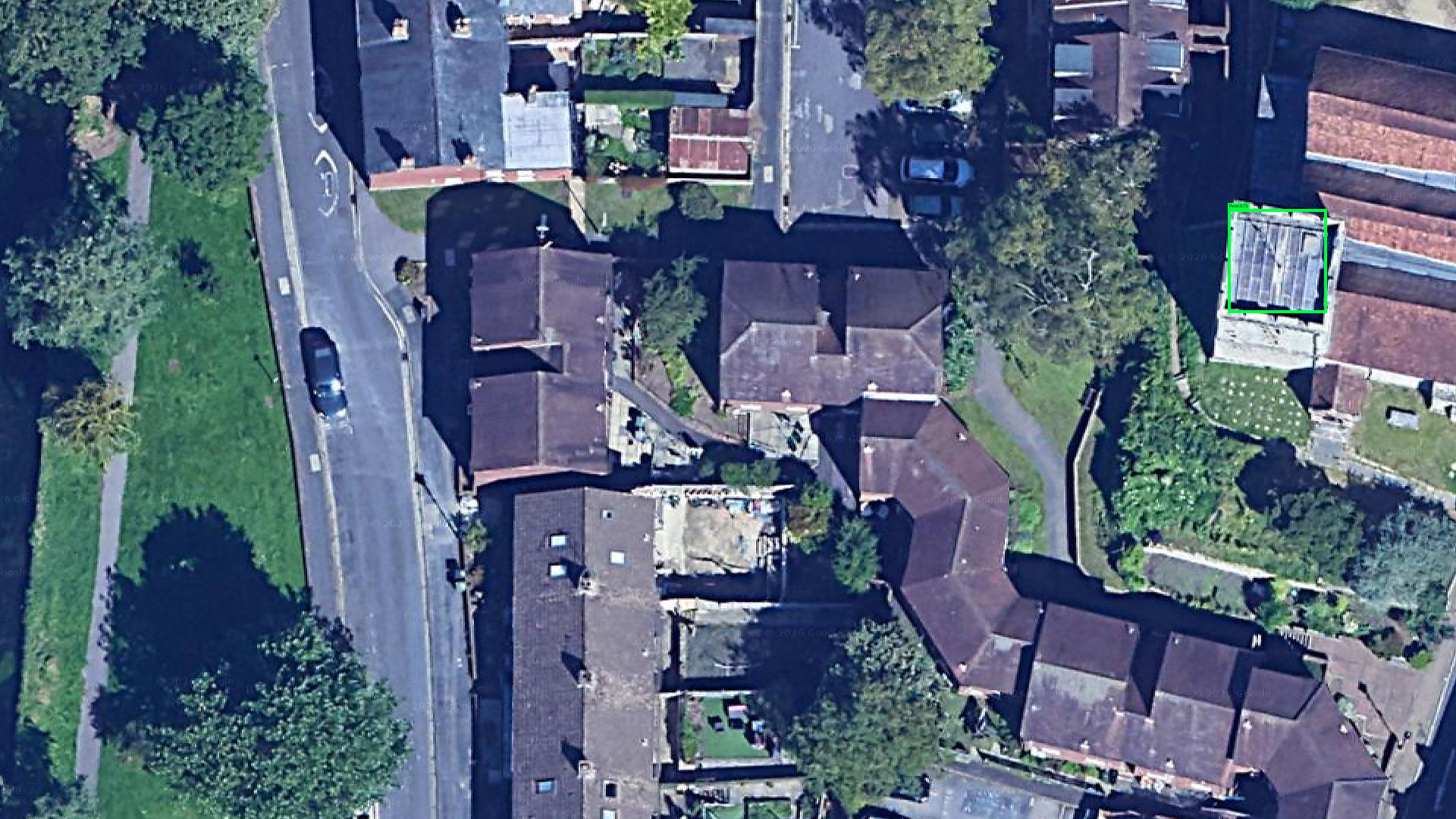
UK - Winchester, England
Solar panel detected · 73% confidence
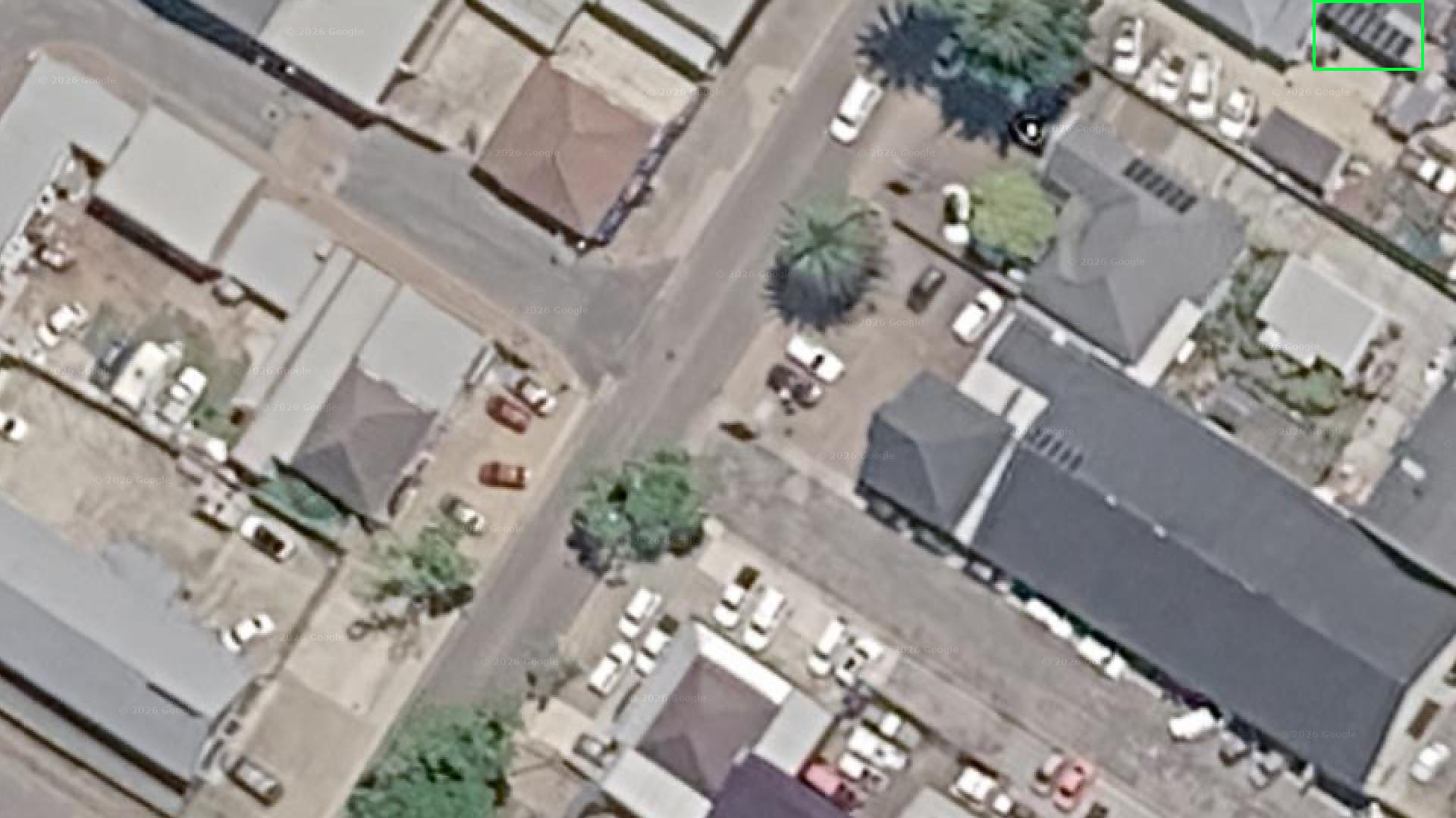
Africa - George, South Africa
Solar panel detected · 71% confidence
Who Would Actually Use This
The honest answer is: quite a few different types of organisations.
Energy companies want to know how solar adoption is spreading across their service areas - not because they’re curious, but because it directly affects grid planning and forecasting. Insurance companies need to verify what’s actually on a roof before writing a policy or settling a claim. Local councils planning green energy incentives need to know where to focus. Real estate teams want to flag solar installations as part of due diligence without hiring inspectors.
All of these use cases have one thing in common: they need accurate, up-to-date rooftop data at a scale that manual methods can’t handle.
What Comes Next
This started as an internal experiment but it’s entirely ready to be turned into a production system. The detection model can be fine-tuned on region-specific imagery to improve accuracy in particular markets. The tool can be extended to process thousands of addresses in batch mode, generate reports, or be embedded as an API inside a larger product.
If you’re working on a problem where understanding what’s on rooftops matters - whether that’s solar, HVAC units, structural damage, or anything else visible from above - we’d like to talk.